NSS4 combiné GPS Sondeur SIMRAD
2 707.92€ – 6 283.80€ TTC
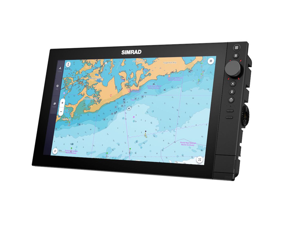
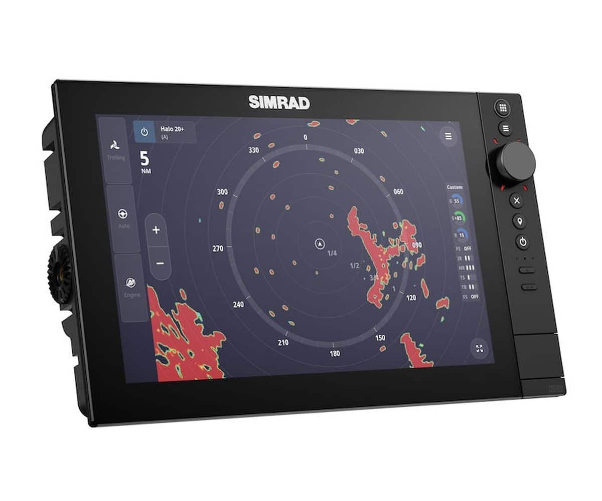
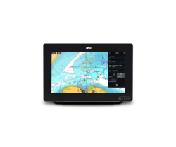
Le SIMRAD NSS4 intègre les carte C-MAP X, un module avec double prise Xsonic sondeur 1kW dual band CHIRP, Side et downscan. Existe en 10”, 12” et 16”.
Le SIMRAD NSS4 : Un Nouveau Standard pour les Passionnés de Pêche
Disponible en écrans de 10″, 12″ et 16″, le NSS4 offre des commandes hybrides, un processeur 8 cœurs ultra-rapide et un sondeur CHIRP double canal. Ainsi, il est idéal pour les passionnés de pêche sportive et les plaisanciers. Par conséquent, il redéfinit les possibilités sur l’eau.
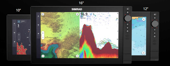
NSS 4 – Conçu pour être plus élégant, rapide et intelligent
Le système propose un trio de commandes hybrides, incluant des interfaces tactiles, rotatives et à clavier. Il arbore un design premium avec du verre jusqu’aux bords. De plus, il est alimenté par un processeur Qualcomm 8 cœurs ultra-rapide. Ce système inclut également un système d’exploitation redessiné.
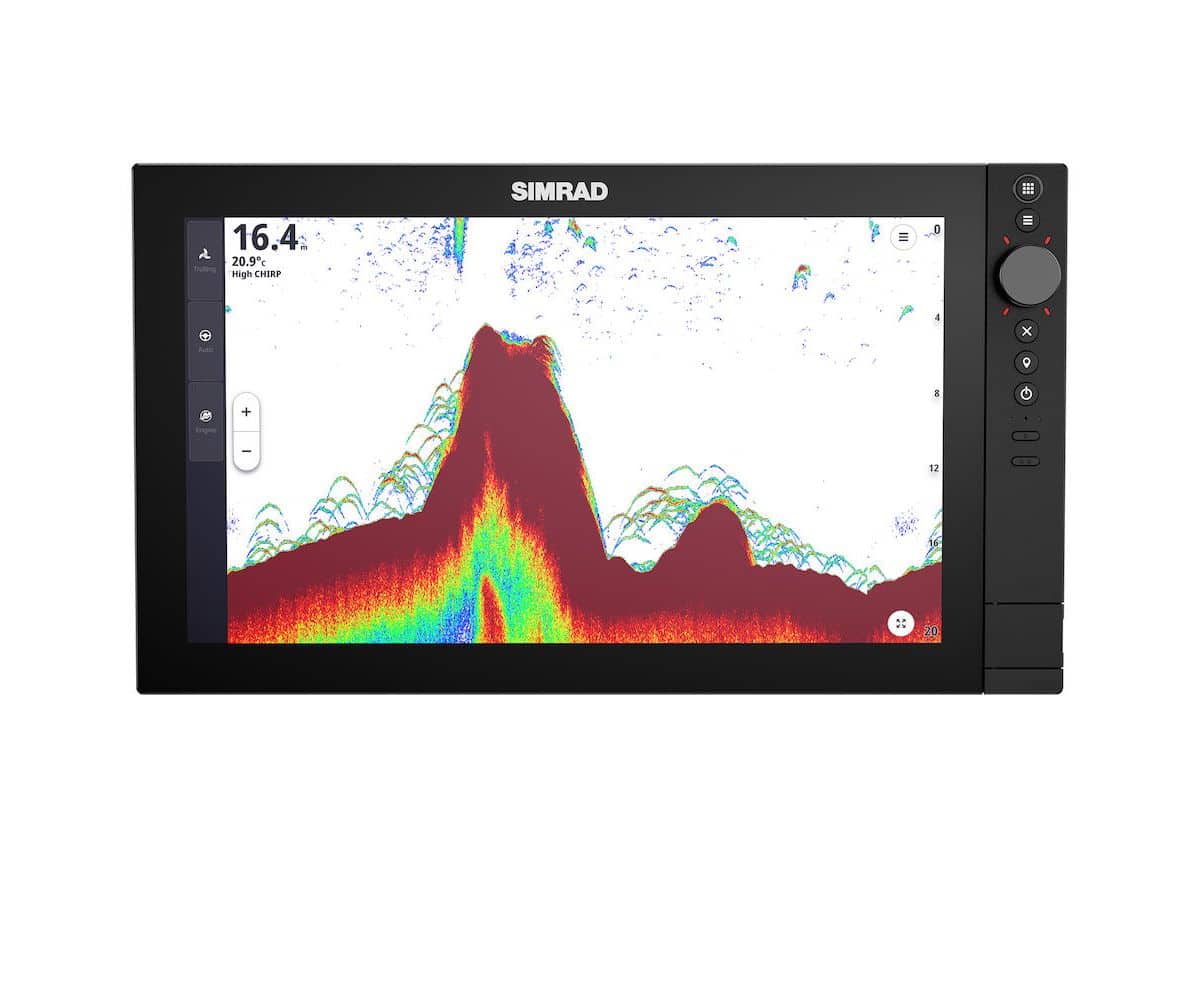
Par ailleurs, le Simrad NSS4 est livré avec un échosondeur CHIRP double canal intégré de 1 kW. En outre, il supporte les technologies Active Imaging et Active Imaging HD. De plus, il est compatible avec les cartes C-MAP X-gen et autres options de cartes.
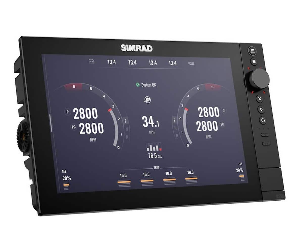
En plus de cela, il s’intègre parfaitement avec Simrad RECON, Rhodan et Motorguide Trolling Motors. Il est également compatible avec la suite Simrad, incluant les modules sonar S3100H & S5100, radar, entre autres. En outre, il fournit un support pour Mercury, CZone, SiriusXM et d’autres systèmes supplémentaires.
Simrad NSS4 Plus élégant
Redessiné de fond en comble, le Simrad NSS4 est désormais plus élégant. Grâce à l’écran tactile, la molette et le clavier, qui fonctionnent en harmonie, pour offrir un contrôle supérieur. À l’intérieur, notre processeur 8 cœurs, le plus puissant, permet des transitions plus fluides et des mises à jour plus rapides.
De plus, les capacités avancées de détection des poissons, telles que le sonar CHIRP double canal 1kW, ainsi que le support Active Imaging HD et la personnalisation améliorée, complètent le package de notre traceur de cartes et sondeur sportif haut de gamme.
Par conséquent, il est parfait pour les passionnés de pêche sportive et les plaisanciers.
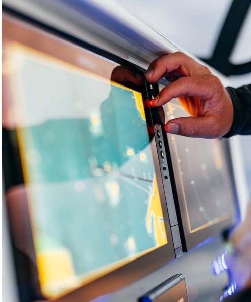
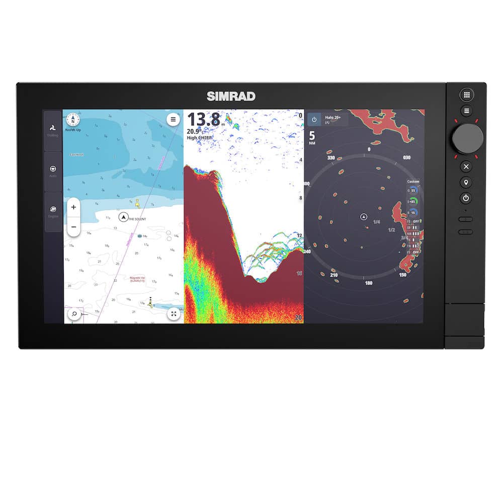
Plus rapide
Me Simrad NSS4 s’impose comme une référence. De plus, l’écran tactile, la molette et le clavier fonctionnent en parfaite harmonie pour offrir un contrôle supérieur.
À l’intérieur, notre processeur 8 cœurs, le plus puissant à ce jour, garantit des transitions plus fluides ainsi que des mises à jour nettement plus rapides.
En outre, les capacités avancées de détection des poissons, telles que le sonar CHIRP double canal 1kW, le support Active Imaging HD et la personnalisation améliorée, viennent compléter ce package. Par conséquent, notre traceur de cartes et sondeur sportif haut de gamme est idéal pour les passionnés de pêche sportive mais aussi pour les plaisanciers.
Plus intelligent
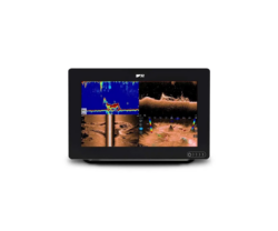
Le Simrad NSS4 introduit également de nouvelles capacités de pêche. En effet, vous pouvez suivre quatre sources sonar sur un seul écran et utiliser le marquage de poisson Waypoint pour repérer les meilleurs endroits de pêche avec des icônes d’espèces uniques pour une référence facile.
Par ailleurs, un échosondeur CHIRP 1kW double canal fournit une séparation des cibles améliorée et une image plus claire et plus complète des eaux sous-marines.
De plus, le support pour l’impressionnante Active Imaging HD permet d’obtenir des images de structures sous-marines et de poissons qui sont plus claires que jamais.
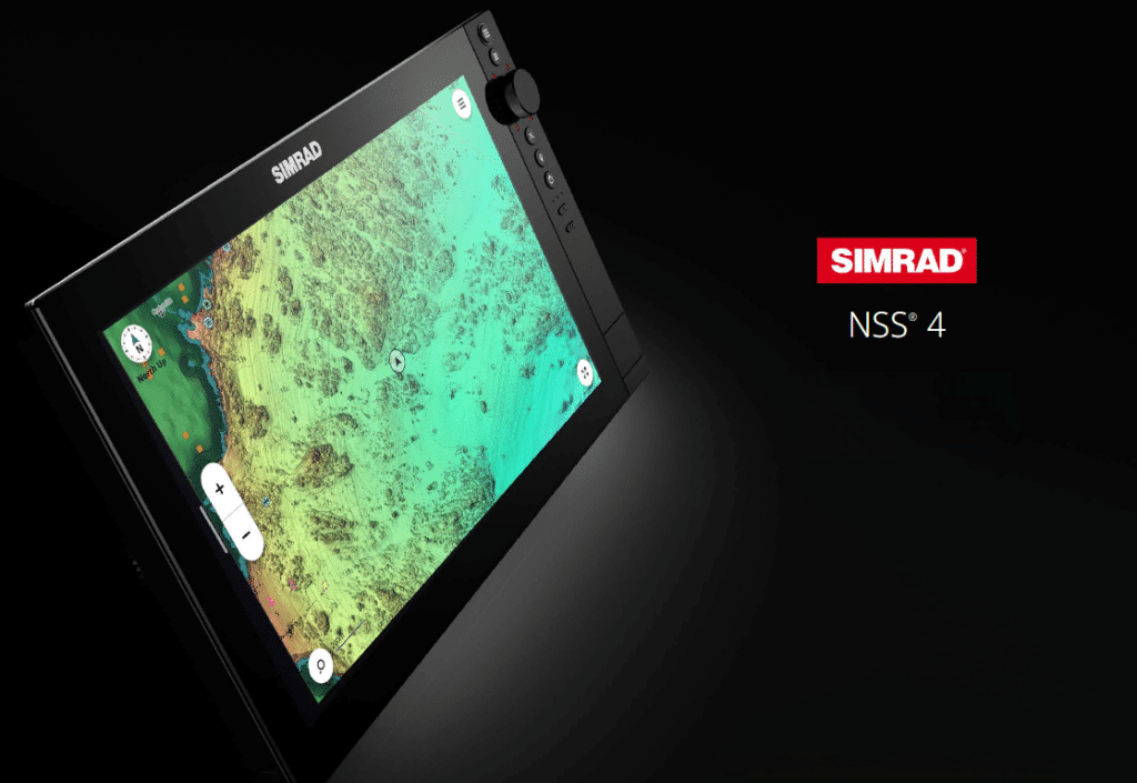
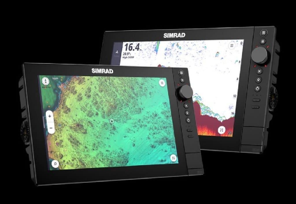
Intégration C-MAP nouvelle génération
Les cartes C-MAP X-Gen du Simrad NSS4 offrent une navigation avancée. Les cartes DISCOVER X incluent des capacités de zoom instantané. Quant à REVEAL X, il propose un relief ombré et des images satellites. Par ailleurs, le NSS 4 est également compatible avec des cartes tierces telles que CMOR Mapping, avec des options supplémentaires attendues à l’avenir.
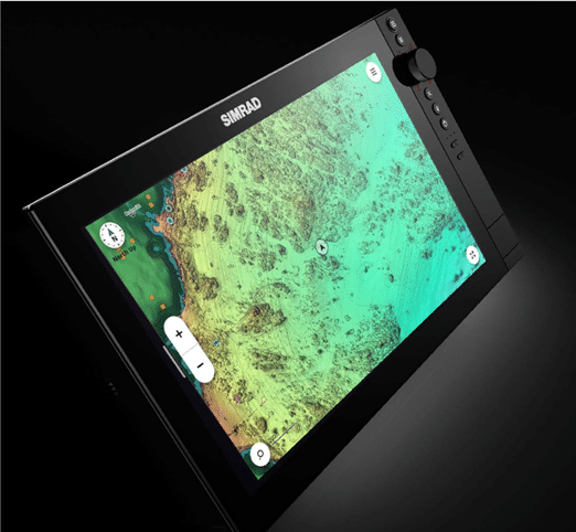
Les cartes C-MAP X-Gen sont une véritable révolution dans le domaine de la navigation maritime. En effet, elles offrent des fonctionnalités avancées qui facilitent grandement l’expérience des plaisanciers et des pêcheurs. Parmi les nouveautés, il y a les cartes DISCOVER X qui se distinguent par leurs capacités de zoom instantané, permettant d’obtenir rapidement des détails précis sur la zone de navigation.
De plus, les cartes REVEAL X introduisent un relief ombré et des images satellites, offrant une vision encore plus réaliste et détaillée des fonds marins et des paysages côtiers.
Ces cartes ont été conçues pour s’intégrer parfaitement avec le Simrad NSS4, fournissant ainsi une navigation avancée et intuitive.
Grâce à cette compatibilité, les utilisateurs peuvent bénéficier de données cartographiques améliorées et d’une interface utilisateur simplifiée, rendant la planification de routes et la détection de poissons plus efficaces que jamais.
Enfin, les cartes C-MAP X-Gen représentent une avancée significative pour tous ceux qui prennent la mer, rendant leur expérience de navigation plus précise, plus sûre et plus agréable.
Intégré pour l’avenir
Notre dernier système d’exploitation a l’intégration au cœur du Simrad NSS4. En effet, connectez-vous sans effort avec nos radars HALO les plus puissants, le moteur de traîne RECON, l’incroyable application Simrad et plus encore. Le NSS 4 offre également un support étendu (et toujours en expansion) pour la technologie tierce telle que Mercury SmartCraft Connect, SiriusXM*, CZone pour la commutation numérique, et bien plus encore.
Le NSS 4 offre également un support étendu (et toujours en expansion) pour la technologie tierce telle que Mercury SmartCraft Connect, SiriusXM*, CZone pour la commutation numérique, et bien plus encore.
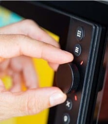
- Le système propose un trio de commandes hybrides, incluant des interfaces tactiles, rotatives et à clavier.
- Il arbore un design premium avec du verre jusqu’aux bords.
- Alimenté par un processeur Qualcomm 8 cœurs ultra-rapide.
- Inclut un système d’exploitation redessiné.
- Livré avec un échosondeur CHIRP double canal intégré de 1 kW.
- Supporte les technologies Active Imaging et Active Imaging HD.
- Compatible avec les cartes C-MAP X-gen et autres options de cartes.
- S’intègre parfaitement avec Simrad RECON, Rhodan et Motorguide Trolling Motors.
- Compatible avec la suite Simrad, incluant les modules sonar S3100H & S5100, radar, entre autres.
- Fournit un support pour Mercury, CZone, SiriusXM et d’autres systèmes supplémentaires.
DONNEES TECHNIQUES DU NSS 4
Simrad NSS4 en 10’’
| Category | Details |
| Autopilot Manouevres / Turn Patterns | U-Turn, C-Turn, Spiral, S-Turn, Square, Zig-zag, Depth |
| Steering Modes | Heading Hold, No Drift, Follow-up, Non-Follow-up, Nav |
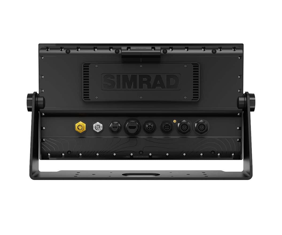
| Connectivity – Ethernet | 1 port (X-Coded M12 GbE), 1 port (yellow, 5-pin) |
Connectivity – N2K PGNs (Receive only) |
59392 ISO Acknowledgement, 59904 ISO Request, 60160 ISO Transport Protocol, Data Transfer, 60416 ISO Transport Protocol, Connection M., 65240 ISO Commanded Address, 60928 ISO Address Claim, 126208 ISO Command Group Function, 126992 System Time, 126996 Product Info, 126998 Configuration Information, 127233 Man Overboard Notification (MOB), 127237 Heading/Track Control, 127245 Rudder, 127250 Vessel Heading, 127251 Rate of Turn, 127252 Heave, 127257 Attitude, 127258 Magnetic Variation, 127488 Engine Parameters, Rapid Update, 127489 Engine Parameters, Dynamic, 127493 Transmission Parameters, Dynamic, 127500 Load Controller Connection State / Control, 127501 Binary Status Report, 127503 AC input status, 127504 AC Output Status, 127505 Fluid Level, 127506 DC Detailed Status, 127507 Charger Status, 127508 Battery Status, 127509 Inverter Status, 128259 Speed, Water referenced, 128267 Water Depth, 128275 Distance Log, 129025 Position, Rapid Update, 129026 COG & SOG, Rapid Update, 129029 GNSS Position Data, 129033 Time & Date, 129038 AIS Class A Position Report, 129039 AIS Class B Position Report, 129040 AIS Class B Extended Position Report, 129041 AIS aids to Navigation, 129283 Cross Track Error, 129284 Navigation Data, 129539 GNSS DOPs, 129540 AIS Class B Extended Position Report, 129545 GNSS RAIM Output, 129549 DGNSS Corrections, 129551 GNSS Differential Correction Receiver Signal, 129793 AIS UTC and Date Report, 129794 AIS aids to Navigation, 129798 AIS SAR Aircraft Position Report, 129801 Cross Track Error, 129802 AIS Safety Related Broadcast Message, 129283 Cross Track Error, 129284 Navigation Data, 129539 GNSS DOPs, 129540 GNSS Sats in View, 129794 AIS Class A Static and Voyage Related Data, 129801 AIS Addressed Safety Related Message, 129802 AIS Safety Related Broadcast Message, 129808 DSC Call Information, 129809 AIS Class B “CS” Static Data Report, Part A, 129810 AIS Class B “CS” Static Data Report, Part B, 130060 Label, 130074 Route and WP Service – WP List – WP Name & Position, 130306 Wind Data, 130310 Environmental Parameters, 130311 Environmental Parameters, 130312 Temperature, 130313 Humidity, 130314 Actual Pressure, 130316 Temperature, Extended Range, 130569 Entertainment – Current File and Status, 130570 Entertainment – Library Data File, 130571 Entertainment – Library Data Group, 130572 Entertainment – Library Data Search, 130573 Entertainment – Supported Source Data, 130574 Entertainment – Supported Zone Data, 130576 Small Craft Status, 130577 Direction Data, 130578 Vessel Speed Components, 130579 Entertainment – System Configuration Status, 130580 Entertainment – System Configuration Status, 130581 Entertainment – Zone Configuration Status, 130582 Entertainment – Zone Volume Status, 130583 Entertainment – Available Audio EQ Presets, 130584 Entertainment – Bluetooth Devices, 130585 Entertainment – Bluetooth Source Status |
Connectivity – N2K PGNs (Transmit) |
60160 ISO Transport Protocol, Data Transfer, 60416 ISO Transport Protocol, Connection M., 126208 ISO Command Group Function, 126992 System Time, 126993 Heartbeat, 126996 Product Info, 127237 Heading/Track Control, 127250 Vessel Heading, 127258 Magnetic Variation, 127502 Switch Bank Control, 128259 Speed, Water referenced, 128267 Water Depth, 128275 Distance Log, 129025 Position, Rapid Update, 129026 COG & SOG, Rapid Update, 129029 GNSS Position Data, 129283 Cross Track Error, 129285 Navigation – Route/WP Information, 129284 Navigation Data, 129285 Route/Waypoint Data, 129539 GNSS DOPs, 129540 GNSS Sats in View, 130074 Route and WP Service – WP List – WP Name & Position, 130306 Wind Data, 130310 Environmental Parameters, 130311 Environmental Parameters, 130312 Temperature, 130577 Direction Data, 130578 Vessel Speed Components |
| Connectivity – NMEA 0183 | No |
| Connectivity – NMEA 2000 | 1 x NMEA 2000 Micro-C port, 1 LEN |
| Connectivity – PC Connectivity | No |
| Connectivity – Video | HDMI Video In, IPCAM-1, FLIR 232/300 series. ONVIF IP Camera |
| Connectivity – WiFi | Wi-Fi 5 (IEEE 802.11ax) |
| Display – Backlight Color | White |
| Display – Resolution | 1280 x 800 |
| Display – Screen Brightness | >1200 nits |
| Display – Size and Type | 10″ SolarMax IPS Touchscreen display |
| Display – Viewing Angles | 80° top/bottom, 80° left/right |
| Electrical – Power Consumption, max. | 28 W |
| Electrical – Recommended Fuse Rating | 5 A |
| Electrical – Supply Voltage | 12/24 V DC (10 – 31.2 V DC min – max) |
| Environment – Operating Temperature Range | -15°C to 55°C (5°F to 131°F) |
| Environment – Shock and Vibration | 100,000 cycles of 20 G |
| Environment – Storage Temperature Range | -20°C to 60°C (-4°F to 140°F) |
| Environment – Waterproof rating | IPX6 and IPX7 |
| MFD – AIS | Receive AIS data over NMEA 2000 |
| MFD – Autopilot | NAC-1, NAC-2, NAC3, NAC-D compatible |
| MFD – Cartography included | World wide basemap (not for navigation) |
| MFD – Cartography supported | C-MAP Discover X, C-MAP Reveal X, Third party charts CMOR, StikeLines |
| MFD – Digital Switching | Czone / DDS |
| MFD – External Storage | 2x (microSD, SDHC) |
| MFD – GPS | 10 Hz GNSS receiver for GPS and GLONASS, supports combinations with Galileo, Beidou, QZSS. SBAS (WAAS) |
| MFD – Radar | Halo dome radars, Halo open array radars, 3G/4G, 10/25 kW HD Radars |
MFD – Sonar |
Two 9 pin Xsonic 1 kW Sonar ports. Sonar port: Low, Medium, and High Chirp up to 1kW RMS: Downscan: 455 kHz, 800 kHz, 700 kHz CHIRP, 1200 kHz CHIRP. Imaging port: Sonar: Low, Medium, and High Chirp up to 1kW RMS. Downscan: 455 kHz, 800 kHz, 700 kHz CHIRP, 1200 kHz CHIRP. Sidescan: 455 kHz, 800 kHz, 455 kHz CHIRP, 1200 kHz CHIRP. Network Sonar modules S3100, S5100 |
| MFD – Waypoints, Routes, Tracks | 10,000 waypoints: 75,000 trackpoints: 75 saved tracks: 125 routes. Note: NSS/NSO evo2/3 maximums will apply if on the same network |
| MFD – Compass Safe Distance | 35 cm (1.15 ft) |
| Physical – Dimensions (W x H x D) | Display only: 287.9 mm x 176.1 mm x 79.6 mm (11.33″ x 6.93″ x 3.13″), With bracket: 315.8 mm x 196.5 mm x 79.6 mm (12.43″ x 7.73″ x 3.13″) |
| Physical – Mounting Type | Bracket mount (bracket supplied). Rear mount (brackets supplied) |
| Physical – Weight | 1.8 kg (3.97 lb) |
| Other – Warranty Period | 2 Years |
| Other – Interface | Hybrid multi-touch screen, buttons, and rotary knob |
Other – Languages |
-German (Deutsch)-English (English)-Dutch (Nederlands)-Danish (Dansk)-Spanish (Español)-French (Français)-Italian (Italiano)-Norwegian (Norsk)-Portuguese (Português)-Finnish (Suomi)-Swedish (Svenska)-Icelandic (Islenska)-Greek (ελληνικά)-Chinese (中文)-Turkish (Türkçe)-Estonian (Eesti)-Croatian (Hrvatski)-Lithuanian (Lietuvių)-Latvian (Latviešu)-Polish (Polski)-Chinese Simplified (中文)-Japanese (日本語)-Korean (한국어)-Ukrainian |
Simrad NSS4 -12
| Category | Details |
| Autopilot Manouevres / Turn Patterns | U-Turn, C-Turn, Spiral, S-Turn, Square, Zig-zag, Depth |
| Steering Modes | Heading Hold, No Drift, Follow-up, Non-Follow-up, Nav |
| Connectivity | Ethernet: 1 port (X-Coded M12 GbE), 1 port (yellow, 5-pin) |
N2K PGNs |
Receive only: 59392, 59904, 60160, 60416, 65240, 60928, 126208, 126992, 126996, 126998, 127233, 127237, 127245, 127250, 127251, 127252, 127257, 127258, 127488, 127489, 127493, 127500, 127501, 127503, 127504, 127505, 127506, 127507, 127508, 127509, 128259, 128267, 128275, 129025, 129026, 129029, 129033, 129038, 129039, 129040, 129041, 129283, 129284, 129539, 129540, 129545, 129549, 129551, 129793, 129794, 129798, 129801, 129802, 129808, 129809, 129810, 130060, 130074, 130306, 130310, 130311, 130312, 130313, 130314, 130316, 130569, 130570, 130571, 130572, 130573, 130574, 130576, 130577, 130578, 130579, 130580, 130581, 130582, 130583, 130584, 130585. Transmit: 60160, 60416, 126208, 126992, 126993, 126996, 127237, 127250, 127258, 127502, 128259, 128267, 128275, 129025, 129026, 129029, 129283, 129285, 129284, 129285, 129539, 129540, 130074, 130306, 130310, 130311, 130312, 130577, 130578 |
| NMEA 0183 | No |
| NMEA 2000 | 1 x NMEA 2000 Micro-C port, 1 LEN |
| PC Connectivity | No |
| Video | HDMI Video In, Video out via USB. IPCAM-1, FLIR 232/300 series. ONVIF IP Camera |
| WiFi | Wi-Fi 5 (IEEE 802.11ax) |
Display |
Backlight Color: White, Resolution: 1280 x 800, Screen Brightness: >1200 nits, Size and Type: 12″ SolarMax IPS Touchscreen display, Viewing Angles: 80° top/bottom, 80° left/right |
| Electrical | Power Consumption, max.: 40 W, Recommended Fuse Rating: 5 A, Supply Voltage: 12/24 V DC (10 – 31.2 V DC min – max) |
| Environment | Operating Temperature Range: -15°C to 55°C (5°F to 131°F), Shock and Vibration: 100,000 cycles of 20 G, Storage Temperature Range: -20°C to 60°C (-4°F to 140°F), Waterproof rating: IPX6 and IPX7 |
MFD |
AIS: Receive AIS data over NMEA 2000, Autopilot: NAC-1, NAC-2, NAC3, NAC-D compatible, Cartography included: World wide basemap (not for navigation), Cartography supported: C-MAP Discover X, C-MAP Reveal X, Third party charts CMOR, StikeLines, Digital Switching: Czone / DDS, External Storage: 2x (microSD, SDHC), 1 x USB port, GPS: 10 Hz GNSS receiver for GPS and GLONASS, supports combinations with Galileo, Beidou, QZSS. SBAS (WAAS), Radar (inc. compatibility): Halo dome radars, Halo open array radars, 3G/4G, 10/25 kW HD Radars, Sonar (inc. compatibility): Two 9 pin Xsonic 1 kW Sonar ports, Network Sonar modules S3100, S5100, Waypoints, Routes, Tracks: 10,000 waypoints, 75,000 trackpoints, 75 saved tracks, 125 routes, Compass Safe Distance – Metric, imperial: 65 cm (2.1 ft) |
Physical |
Dimensions (W x H x D): Display only: 338.9 mm x 208.4 mm x 84.8 mm (13.34″ x 8.20″ x 3.34″), With bracket: 367.8 mm x 232.8 mm x 84.8 mm (14.48″ x 9.17″ x 3.34″), Mounting Type: Bracket mount (bracket supplied), Rear mount (brackets supplied), Weight: 2.8 kg (6.17 lb) |
Other |
Warranty Period: 2 Years, Interface: Hybrid multi-touch screen, buttons, and rotary knob, Languages: -German (Deutsch)-English (English)-Dutch (Nederlands)-Danish (Dansk)-Spanish (Español)-French (Français)-Italian (Italiano)-Norwegian (Norsk)-Portuguese (Português)-Finnish (Suomi )-Swedish (Svenska)-Icelandic (Islenska)-Greek (ελληνικά)-Chinese (中文)-Turkish (Türkçe)-Estonian (Eesti)-Croatian (Hrvatski)-Lithuanian (Lietuvių)-Latvian (Latviešu )-Polish (Polski)-Chinese Simplified (中文)-Japanese (日本語)-Korean (한국어)-Ukrainian |
Simrad NSS4 -16
| Category | Details |
| Autopilot Manouevres / Turn Patterns | U-Turn, C-Turn, Spiral, S-Turn, Square, Zig-zag, Depth |
| Steering Modes | Heading Hold, No Drift, Follow-up, Non-Follow-up, Nav |
| Connectivity – Ethernet | 1 port (X-Coded M12 GbE)1 port (yellow, 5-pin) |
N2K PGNs – Receive only |
59392 ISO Acknowledgement, 59904 ISO Request, 60160 ISO Transport Protocol, Data Transfer, 60416 ISO Transport Protocol, Connection M., 65240 ISO Commanded Address, 60928 ISO Address Claim, 126208 ISO Command Group Function, 126992 System Time, 126996 Product Info, 126998 Configuration Information, 127233 Man Overboard Notification (MOB), 127237 Heading/Track Control, 127245 Rudder, 127250 Vessel Heading, 127251 Rate of Turn, 127252 Heave, 127257 Attitude, 127258 Magnetic Variation, 127488 Engine Parameters, Rapid Update, 127489 Engine Parameters, Dynamic, 127493 Transmission Parameters, Dynamic, 127500 Load Controller Connection State / Control, 127501 Binary Status Report, 127503 AC input status, 127504 AC Output Status, 127505 Fluid Level, 127506 DC Detailed Status, 127507 Charger Status, 127508 Battery Status, 127509 Inverter Status, 128259 Speed, Water referenced, 128267 Water Depth, 128275 Distance Log, 129025 Position, Rapid Update, 129026 COG & SOG, Rapid Update, 129029 GNSS Position Data, 129033 Time & Date, 129038 AIS Class A Position Report, 129039 AIS Class B Position Report, 129040 AIS Class B Extended Position Report, 129041 AIS aids to Navigation, 129283 Cross Track Error, 129284 Navigation Data, 129539 GNSS DOPs, 129540 AIS Class B Extended Position Report, 129545 GNSS RAIM Output, 129549 DGNSS Corrections, 129551 GNSS Differential Correction Receiver Signal, 129793 AIS UTC and Date Report, 129794 AIS aids to Navigation, 129798 AIS SAR Aircraft Position Report, 129801 Cross Track Error, 129802 AIS Safety Related Broadcast Message, 129283 Cross Track Error, 129284 Navigation Data, 129539 GNSS DOPs, 129540 GNSS Sats in View, 129794 AIS Class A Static and Voyage Related Data, 129801 AIS Addressed Safety Related Message, 129802 AIS Safety Related Broadcast Message, 129808 DSC Call Information, 129809 AIS Class B “CS” Static Data Report, Part A, 129810 AIS Class B “CS” Static Data Report, Part B, 130060 Label, 130074 Route and WP Service – WP List – WP Name & Position, 130306 Wind Data, 130310 Environmental Parameters, 130311 Environmental Parameters, 130312 Temperature, 130313 Humidity, 130314 Actual Pressure, 130316 Temperature, Extended Range, 130569 Entertainment – Current File and Status, 130570 Entertainment – Library Data File, 130571 Entertainment – Library Data Group, 130572 Entertainment – Library Data Search, 130573 Entertainment – Supported Source Data, 130574 Entertainment – Supported Zone Data, 130576 Small Craft Status, 130577 Direction Data, 130578 Vessel Speed Components, 130579 Entertainment – System Configuration Status, 130580 Entertainment – System Configuration Status, 130581 Entertainment – Zone Configuration Status, 130582 Entertainment – Zone Volume Status, 130583 Entertainment – Available Audio EQ Presets, 130584 Entertainment – Bluetooth Devices, 130585 Entertainment – Bluetooth Source Status |
N2K PGNs – Transmit |
60160 ISO Transport Protocol, Data Transfer, 60416 ISO Transport Protocol, Connection M., 126208 ISO Command Group Function, 126992 System Time, 126993 Heartbeat, 126996 Product Info, 127237 Heading/Track Control, 127250 Vessel Heading, 127258 Magnetic Variation, 127502 Switch Bank Control, 128259 Speed, Water referenced, 128267 Water Depth, 128275 Distance Log, 129025 Position, Rapid Update, 129026 COG & SOG, Rapid Update, 129029 GNSS Position Data, 129283 Cross Track Error, 129285 Navigation – Route/WP Information, 129284 Navigation Data, 129285 Route/Waypoint Data, 129539 GNSS DOPs, 129540 GNSS Sats in View, 130074 Route and WP Service – WP List – WP Name & Position, 130306 Wind Data, 130310 Environmental Parameters, 130311 Environmental Parameters, 130312 Temperature, 130577 Direction Data, 130578 Vessel Speed Components |
| NMEA 0183 | No |
| NMEA 2000 | 1 x NMEA 2000 Micro-C port, 1 LEN |
| PC Connectivity | No |
| Video | HDMI Video In, Video out via USB. IPCAM-1, FLIR 232/300 series. ONVIF IP CameraIP Cameras: IPCAM-1, FLIR 232/300 series. ONVIF IP Cameras |
| WiFi | Wi-Fi 5 (IEEE 802.11ax) |
| Display – Backlight Color | White |
| Display – Resolution | 1920 x 1080 |
| Display – Screen Brightness | >1200 nits |
| Display – Size and Type | 16″ SolarMax IPS Touchscreen display for wide viewing angles, extreme clarity and sunlight viewability with polarized sunglasses |
| Display – Viewing Angles | 80° top/bottom, 80° left/right |
| Electrical – Power Consumption, max. | 43.5 W |
| Electrical – Recommended Fuse Rating | 5 A |
| Electrical – Supply Voltage | 12/24 V DC (10 – 31.2 V DC min – max) |
| Environment – Operating Temperature Range | -15°C to 55°C (5°F to 131°F) |
| Environment – Shock and Vibration | 100,000 cycles of 20 G |
| Environment – Storage Temperature Range | -20°C to 60°C (-4°F to 140°F) |
| Environment – Waterproof rating | IPX6 and IPX7 |
| MFD – AIS | Receive AIS data over NMEA 2000 |
| MFD – Autopilot | NAC-1, NAC-2, NAC3, NAC-D compatible |
| MFD – Cartography included | World wide basemap (not for navigation). Detailed chart card required |
| MFD – Cartography supported | C-MAP Discover X, C-MAP Reveal X. Third party charts CMOR, StikeLines (check with provider for available content) |
| MFD – Digital Switching | Czone / DDS |
| MFD – External Storage | 2x (microSD, SDHC), 1 x USB port |
| MFD – GPS | 10 Hz GNSS receiver for GPS and GLONASS, supports combinations with Galileo, Beidou, QZSS. SBAS (WAAS) |
| MFD – Radar (inc. compatibility) | Halo dome radars, Halo open array radars, 3G/4G, 10/25 kW HD Radars |
MFD – Sonar (inc. compatibility) |
Two 9 pin Xsonic 1 kW Sonar ports. Sonar port: Low, Medium, and High Chirp up to 1kW RMS: Downscan: 455 kHz, 800 kHz, 700 kHz CHIRP, 1200 kHz CHIRP. Imaging port: Sonar: Low, Medium, and High Chirp up to 1kW RMS. Downscan: 455 kHz, 800 kHz, 700 kHz CHIRP, 1200 kHz CHIRP. Sidescan: 455 kHz, 800 kHz, 455 kHz CHIRP, 1200 kHz CHIRPNetwork Sonar modules S3100, S5100 |
| MFD – Waypoints, Routes, Tracks | 10,000 waypoints: 75,000 trackpoints: 75 saved tracks: 125 routes. Note: NSS/NSO evo2/3 maximums will apply if on the same network |
| MFD – Compass Safe Distance | 65 cm (2.1 ft) |
Physical – Dimensions (W x H x D) |
Display only: 423.5 mm x 241.6 mm x 88.6 mm (16.67″ x 9.51″ x 3.49″) With bracket: 453.4 mm x 266.4 mm x 88.6 mm (17.85″ x 10.49″ x 3.49″) |
| Physical – Mounting Type | Bracket mount (bracket optional). Rear mount (brackets supplied) |
| Physical – Weight | 3.8 kg (8.38 lb) |
| Other – Warranty Period | 2 Years |
| Other – Interface | Hybrid multi-touch screen, buttons, and rotary knob |
Other – Languages |
-German (Deutsch)-English (English)-Dutch (Nederlands)-Danish (Dansk)-Spanish (Español)-French (Français)-Italian (Italiano)-Norwegian (Norsk)-Portuguese (Português)-Finnish (Suomi )-Swedish (Svenska)-Icelandic (Islenska)-Greek (ελληνικά)-Chinese (中文)-Turkish (Türkçe)-Estonian (Eesti)-Croatian (Hrvatski)-Lithuanian (Lietuvių)-Latvian (Latviešu )-Polish (Polski)-Chinese Simplified (中文)-Japanese (日本語)-Korean (한국어)-Ukrainian |
| Poids | ND |
|---|---|
| Module sondeur | NON, OUI |
| Taille | 10", 12", 16'' |

